Above: YouTube video from our DVD Revealing God's Treasure 2.0,
available in our store:
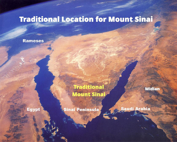
The Traditional Site with zero evidence
There is a traditional route of
the Exodus which has the children of Israel wading in shallow water through an
area north of the Gulf of Suez while the tide was out. This area cannot be the
crossing site as it does not match the biblical account. A shallow area of water
could not drown all of the Egyptian army. Also, they were to leave
Egypt proper before encountering the Red Sea crossing. After crossing the Red Sea, the
Bible says they
encountered the mountain of God or Mount Sinai which is in Midian. Midian
is not in the area we call today the Sinai Peninsula. It is instead in Saudi
Arabia and can be found on most maps in that location. The traditional Mt. Sinai was
"found" by Constantine's "psychic" mother who in the fourth
century went around the Holy Land pointing out various sites as the "authentic"
biblical sites, such as the birthplace of Christ, the church of the Holy
sepulcher (which was a pagan temple during her time), etc. There is no
archaeological evidence of the forty year existence of the children of Israel in the Sinai Peninsula.
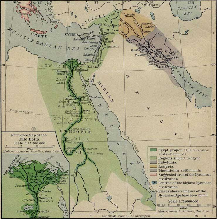
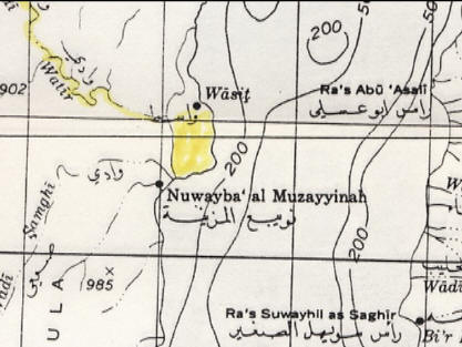
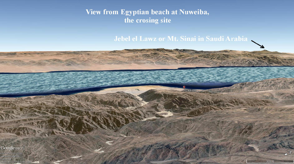
Map above shows us where Midian is located, in Saudi Arabia,
not the Sinai Peninsula.
Also, Egypt proper is shown in dark green. Light green areas are areas
patrolled by Egyptians.
Above: Red Sea Crossing & Mt. Sinai on Shabbat Night Live TV with Kevin
Fisher
The Majority of Archaeologists
The majority of archaeologists today do
not have enough faith in the Bible as the accurate word of God. The
majority of archaeologists do not even believe in the exodus of the children of
Israel from Egypt, according to Hershel Shanks, editor of the Biblical
Archaeology Review magazine. They are skeptical of the biblical account, perhaps because of a lack of
archaeological evidence in the
Sinai Peninsula and a lack of faith. We cannot look to these men to tell
us where or if the exodus took place.
Here is a
great booklet
written by friends of mine which documents Joseph and the children of Israel in
Egypt
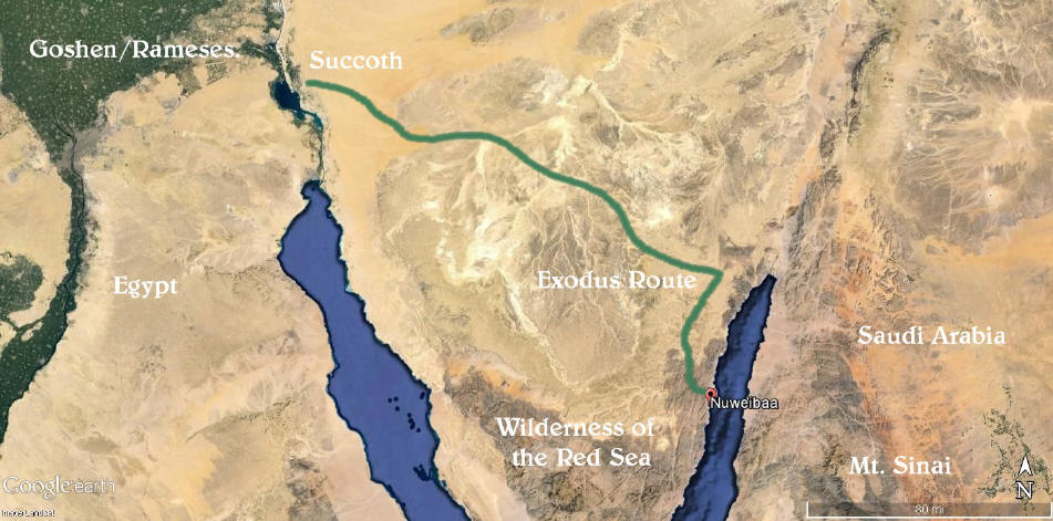
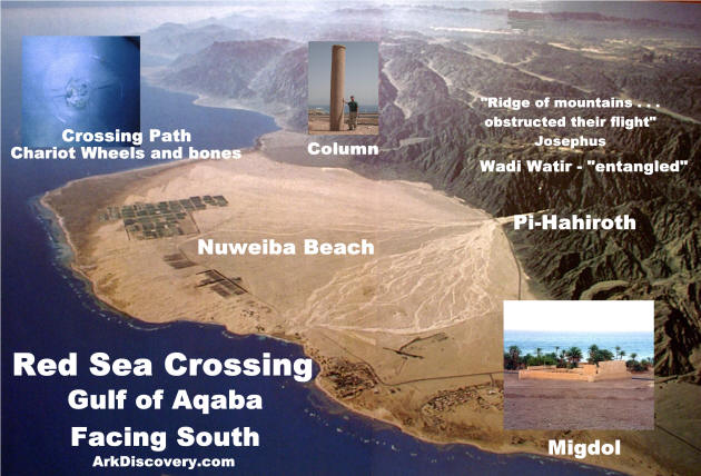
The Red Sea Crossing Site Found by Ron Wyatt
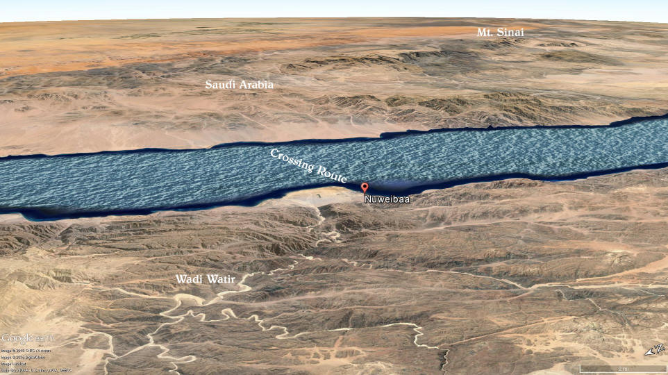
The children of Israel lived in the Nile delta area
or the land of Rameses, and first encamped at the northern end of the Gulf of Suez
or Succoth at the beginning of the Exodus. This was the first point where
they went into the camping mode. Then they traveled through the
wilderness of the Red Sea, or what we
call today the Sinai Peninsula, and
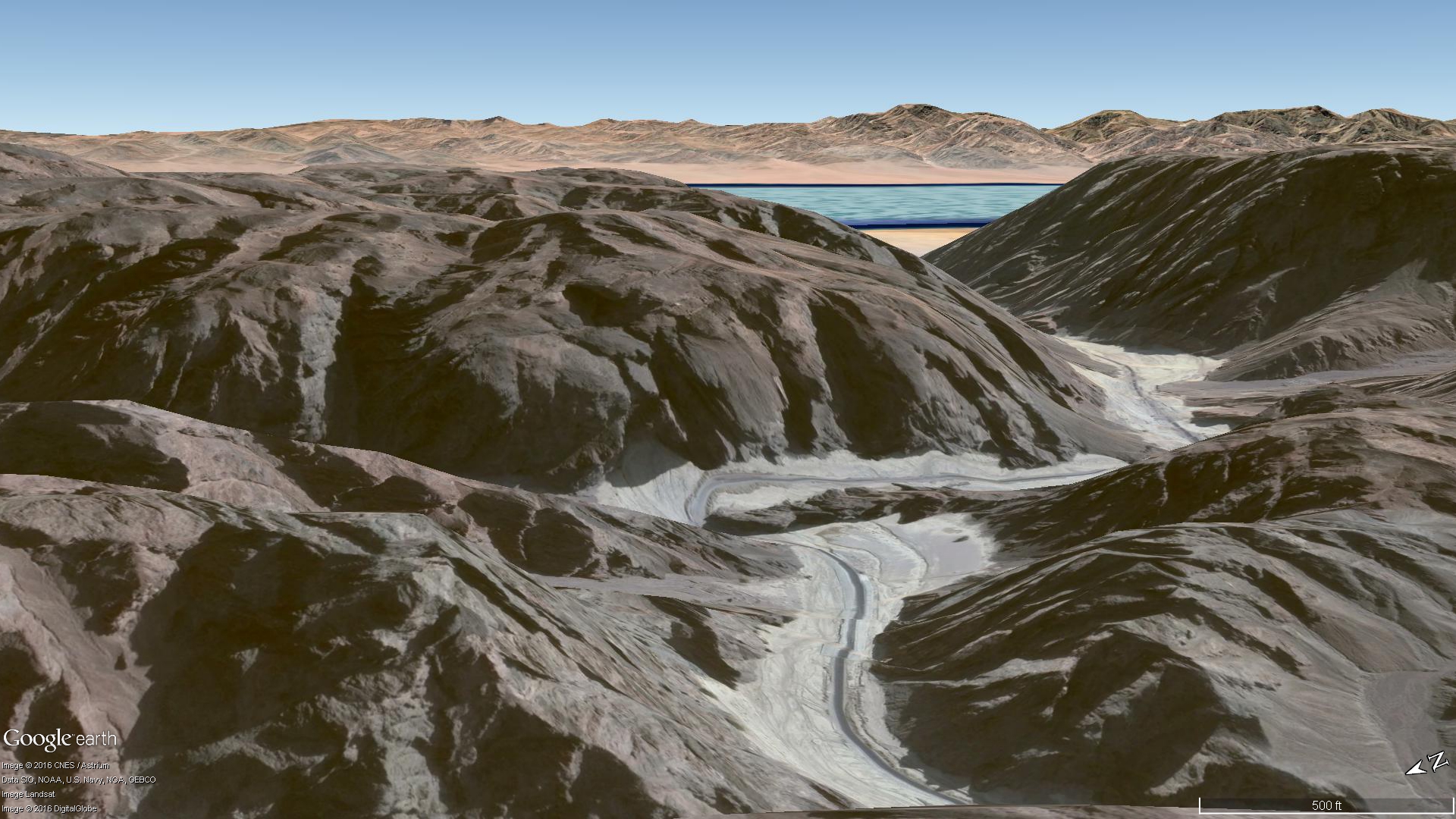
after three days of fast traveling they encountered the Gulf of Aqaba at Nuweiba
Egypt. (I Kings 9:26 calls the Gulf of Aqaba Yam-Suf or the Red
Sea.) When traveling through "the wilderness of the Red Sea"
Ex.13:18, escaping Pharaoh's army, God told Moses to turn south, so they headed
through a wadi or canyon area that is called the Wadi Watir which led to the
sea.
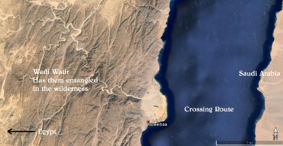
The Wilderness Has Them Entangled
Above: The Bible in
Exodus. 14:3 says, "They are entangled in the land, the wilderness hath shut
them in."
The children of Israel
traveled 20 miles through this canyon area on route to the Red Sea crossing.
"...they drove them into a narrow place"
Josephus, Antiquities of the Jews, 2.15.3
"...they were encompassed with mountains, the
sea, and their enemies" Josephus, Antiquities of the Jews, 2.15.4
Above: The children of Israel were near the beach of the
crossing site.
Above: The five mile long beach where the children of
Israel were trapped at this dead-end.
Some were ready to blame Moses for
their soon defeat
at the hands of the encroaching Egyptian army.
The Beach Where the Crossing
Took Place
When arriving at the beach, the children of Israel felt
trapped, as they could not turn back, nor head north because at the northern end
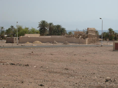
of the beach was a three story, Egyptian military fortress which is still standing today
undergoing restoration.
Egyptian military fortress, blocked any northern escape route
along the beach.
Gulf of Aqaba in the distance, mountains to our back here. (photo 2005
KF)
Josephus said:
"For there was [on each side] a [ridge of] mountains that
terminated
at the sea, which were impassable by reason of their roughness,
and obstructed their flight." Antiquities of the Jews, Bk 2,
15-3
Here we see the mountains that were obstructing their escape. To the south the mountains came down to the sea, as mentioned by
Josephus,
"For there was [on each side] a [ridge of] mountains that
terminated at the sea, which were impassable by reason of their roughness, and
obstructed their flight" Antiquities of the Jews, Bk. 2, 15-3.
You can see the mountains at the beach today.
The people were about to turn against Moses because he had led them to an area
where they were trapped and would surely die, or so they thought.
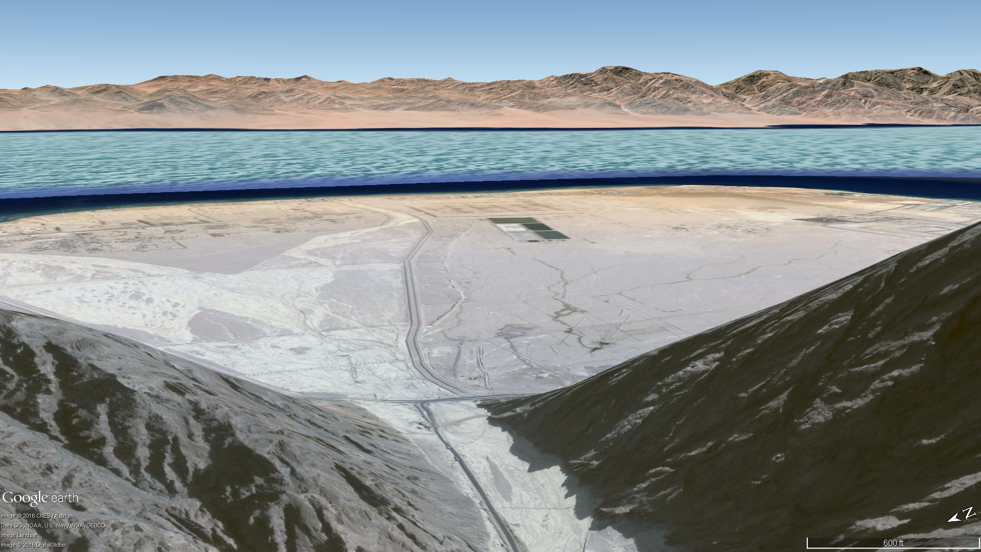
If one looks on a map for a beach area large enough for 2 million
people to encamp on the gulf there is only one candidate: Nuweiba Egypt.
The beach at Nuweiba is extremely large and could have accommodated a large
number of
people at the time of Moses.
Exodus
14:1,2
"And the LORD spake unto Moses, saying,
Speak unto the children of Israel, that they turn and encamp before Pihahiroth,
between Migdol and the sea, over against Baalzephon: before it shall ye encamp
by the sea."
Pi-Hahiroth means, mouth of the hole,
which we would apply to the mouth of the canyon above.
Migdol may actually be the mountains at this location.
"The Gesenius' Hebrew and Chaldee Definition states:
מִגְדֹּל [Migdol] ... This
name is written in Egyptian
(abundance of
hills), which as a foreign name the Hebrews appear to have changed into
מִגְדֹּל
(Tower) ..." So if we use mountains for the translation of Migdol,
they encamped between the mountains and the sea.
Today you will find many hotels
at this five mile long beach and a village.
Subscribe to our YouTube
Channel click here and
then click subscribe
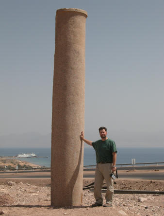
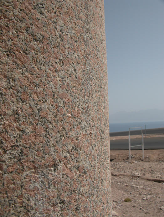
The Granite Column of Solomon
This column matches one on the other side of the gulf in Saudi
Arabia which had the inscriptions intact. The Hebrew words Mizram (Egypt), death,
water, pharaoh, Edom, Yahweh, and Solomon were on that column. Apparently one can
conclude
Kevin Fisher at the red granite column, marking the crossing site (Oct.
2005)
King Solomon had these columns
erected 400 years after the miracle of the crossing of the Red Sea on dry
land. Solomon's sea port was at the northern tip of the Gulf of Aqaba at
Eilat
(I Kings 9:26) and he was very familiar with the Red Sea crossing site, as it was in his neighborhood. The Bible even
mentions this column! Isaiah 19:19, "In that day there will be an
altar to the Lord in the midst of the land of Egypt, and a pillar to the Lord at its
border." You used to be able to visit the beach and
see the column in person, as I was able to do on several occasions, but sadly,
on my trip in November 2024, the column was GONE. Apparently the
government has taken it away to cover up this evidence of truth that confirms
the story of the crossing at this beach. I was almost in tears seeing the
site without the pillar.
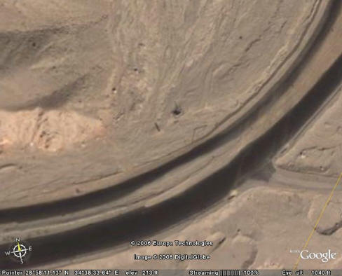
Above we can see the pillar on Google Earth, about 500 feet
from the Gulf.
Top of photo shows us where the column was. The
right side has Nuweiba labled
on the Google Earth map. This is the spot where Ron Wyatt found the column
lying at the edge of the water. The name Nuweiba is short for the name listed below:
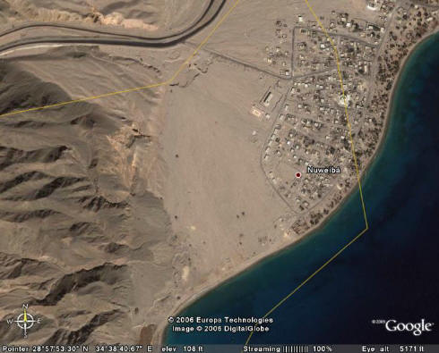
Above, we see the full name Nuwayba' al Muzayyinah which means,
Nuweiba means water,
and Muzayyinah we are told means Moses.
Gradual Contour of Seabed
God caused a strong east wind to blow the waters back so the people could walk
13 miles through the Red
Sea to safety in Arabia. The crossing path is about a quarter to a half mile wide and is on a
gradual slope down to the bottom of the Red Sea and then up to the Saudi beach. On either side of this
path are the depths of the Red Sea, the Eilat Deep and the Aragonese Deep, each
5000 and 6000 feet deep respectively.
View at Red Sea crossing. Saudi Arabia in distance.
"Are you not the One...that made the depths of
the sea a road."
Isaiah 51:10
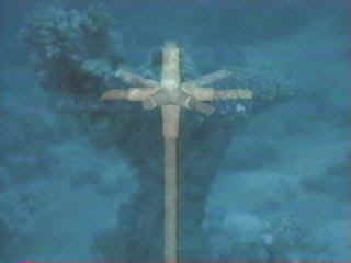
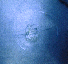
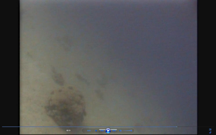
Chariot Wheels Found in the Sea at Nuweiba!
Above, chariot wheels fixed to axels standing at attention on
the seabed.
Above, left, photo taken of a gilded chariot wheel that remains
on the sea floor. It was found by Ron Wyatt using a molecular frequency
generator from his boat above, after he set the equipment to search for gold.
The Bible said all the chariots of Egypt and 600 choice chariots, or gold
veneered models, were in the army pursuing God's people. It is speculated
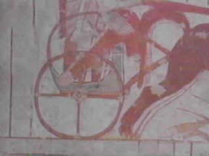
there were 20,000 chariots destroyed that day. Above, right, is a drawing
of a four spoke chariot found in an Egyptian tomb from the same time period.
Four, six and eight spoke wheels are found here in the gulf, and were only used at the
same time during the 18th dynasty or 1446 BC when the exodus took place.
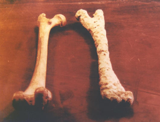
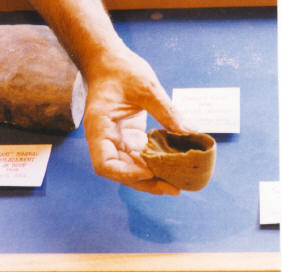
There are numerous chariot wheels, plus human and horse bones at
the crossing site. Above on right, is a human femur bone that is covered by
coral, and was tested at Stockholm University. It is from the right leg of
a man 165-170cm tall. It is basically mineralized by resting in the Red
Sea for 3500 years.
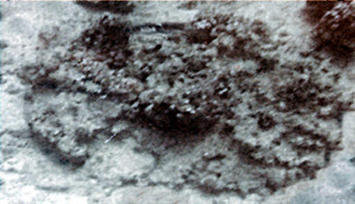
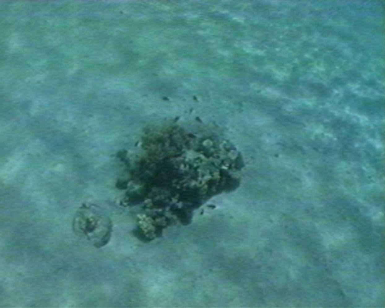
Above is a coral covered chariot wheel on a vertical axle at
is buried in the sand.
Although this is atypical, Bill Fry found this within 10 minutes of searching at Nuweiba.
Above: Ron Wyatt found this wheel with the raised center
hub. A common marker is
the raised center hub that will give a metal reading when tested.
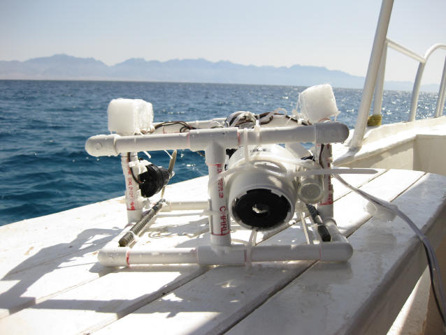
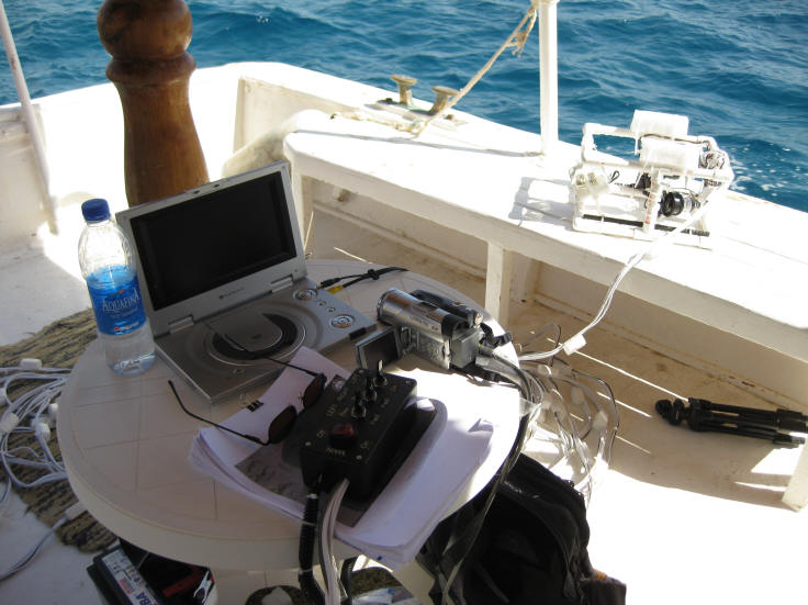
Above: I was able to make this ROV from a kit which had
three motors and a video camera.
Above: Live video feed from the ROV was fed into another
camera for recording purposes.
The 100 foot tether connected to controls for left, right, up, down. We
ran this for about 3 hours.
Above: A chariot wheel was found, possibly connected to
an axle. Notice the raised center hub.
It is against the law to anchor a boat so we were floating by when this image
was shot by the ROV.
Above is a horse's hoof that is shrunken since drying out.
Horses are not found in the
Sinai Peninsula today
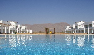
Visit Nuweiba Egypt at the Red Sea Crossing
Stay at SwissCare Hotel, may be closed now. Check online.
www.swisscare-hotels.com
They can pick you up at Cairo airport or at Taba border crossing at Eilat,
Israel
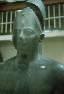
Ron Wyatt believed Thutmoses 1 became Amenhotep 1 when he went
from co-regent to emperor of Egypt or the Pharaoh of Egypt when Moses was born. Therefore, these two names are the same person.
First, a history of Moses having lived in
Egypt is found there
prior to the exodus taking place. Most archaeologists do not believe
the children of Israel ever lived in Egypt.
.
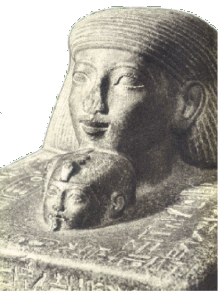
Above, baby Moses or Senmut, then right, Moses or Thutmoses 2 as an adult
with serpent on forehead meaning Crown Prince,
- THUTMOSES 1/
AMENHOTEP 1 = Pharaoh at Moses' birth
- NEFURE /HATSHEPSUT =
"Pharaoh's daughter" and Moses' mother
- SENMUT = Moses
- HATSHEPSUT XNEM AMEN
= Moses
- THUTMOSES 2 =
Moses
- THUTMOSES 3/
AMENHOTEP 2 = Pharaoh when he fled
- THUTMOSES 4/
AMENHOTEP 3 = Pharaoh of the Exodus
- TUTANKHAMEN =
1st-born son of Pharaoh
_______
BIBLICAL
CHRONOLOGY
1706 BC - Jacob 130 yrs when comes to Egypt to live (Genesis 47:9)
1635 BC - Joseph dies at 110 yrs
1526 BC - Moses born
1486 BC - Moses flees from Egypt at age 40 yrs
1446 BC - THE EXODUS (Moses dies at 120 yrs 1406 BC (Deu. 34:7)
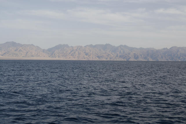
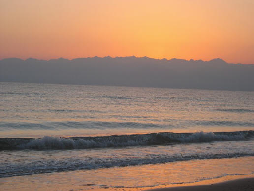
Above: We look across the Gulf of Aqaba and see the
mountains of Saudi Arabia and know that
Mt. Sinai
MUST be in there, not in the Sinai Peninsula
Above: From Nuweiba we can see the real Mt. Sinai with
its blackened peak over in Saudi Arabia.
Above, round chariot wheel found off the Gulf of Aqaba coast of Saudi Arabia,
opposite of Nuweiba, Egypt. (photo Viveka Ponten)
Saudi officials in 2016 have said they can see chariot wheels in the water from
the air when flying over this area.
Above, same wheel but showing the chariot cab next to it. (photo Viveka Ponten)
We made it over to Saudi Arabia in 2020 and
filmed the area,
see Shabbat Night Live programs on YouTube
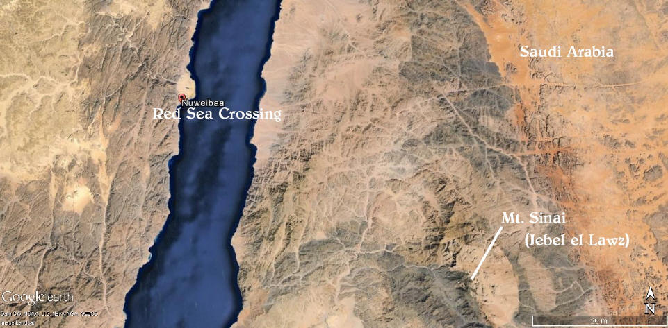
Above we see the crossing site at the large beach, and we see
the real Mt. Sinai in the lower right
in Saudi Arabia, in Midian, named Jebel el Lawz.
The documentary, Patterns of Evidence,
on DVD, covers this Red Sea crossing site.
production by Mahoney Media, Red Sea Miracle II.
See www.PatternsOfEvidence.com
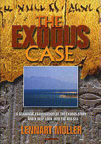
The Exodus Case book
A wonderful book is available covering the Red Sea
crossing. You may
order it from www.amazon.com Written by a Swedish scientist,
Dr. Lennart Moller, who has extensively researched
the material first hand. The book has over 550 color illustrations
including topics of Sodom and Gomorrah, the Red Sea Crossing, the real Mount
Sinai, and Joseph's grain storage complex.