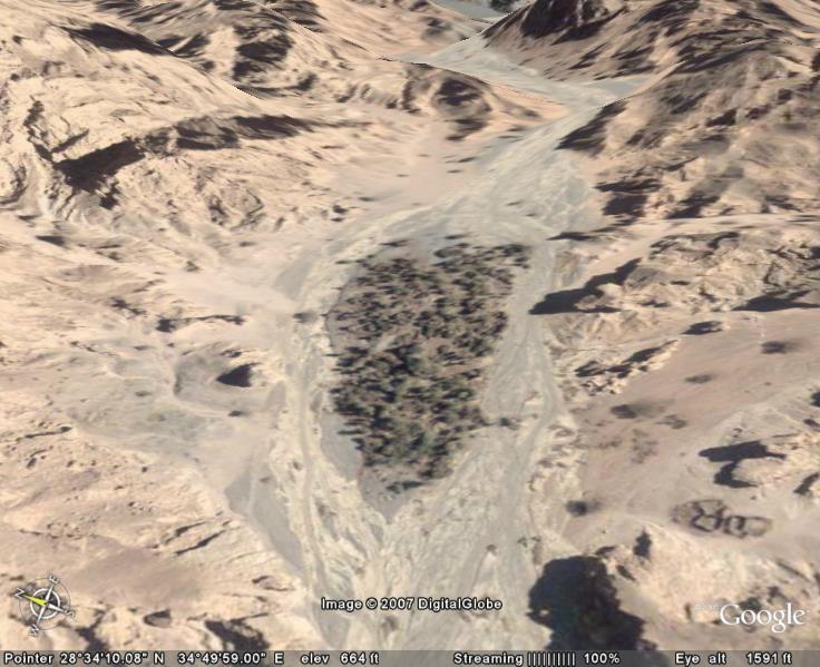
Above: Google Earth image of the oasis
of Elim in Saudi Arabia in the
Midian Region, with 12 wells
as mentioned in the Bible. On the pathway to Mt. Sinai in Arabia.
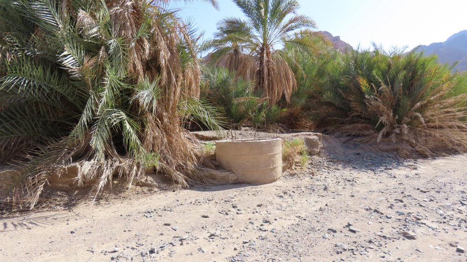
Above: Elim with the 12 wells. We
walked into this area 3 miles from the Gulf of Aqaba area.
It is considered a park, with police in the parking area. Photo
Kevin Fisher
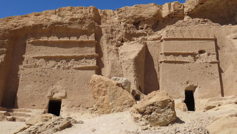
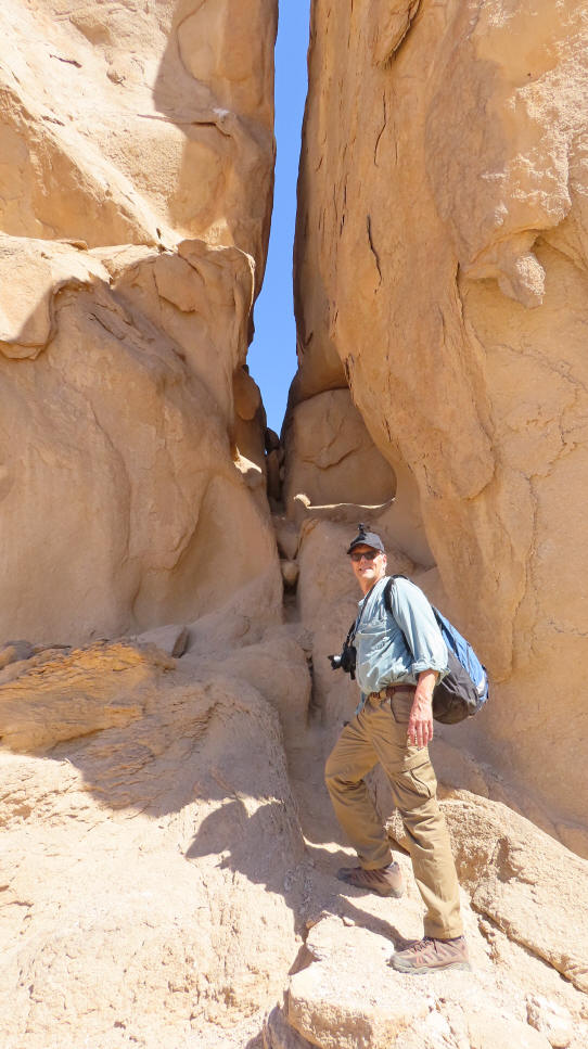
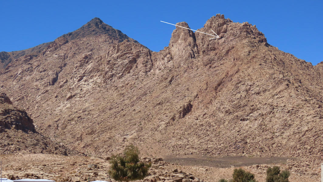
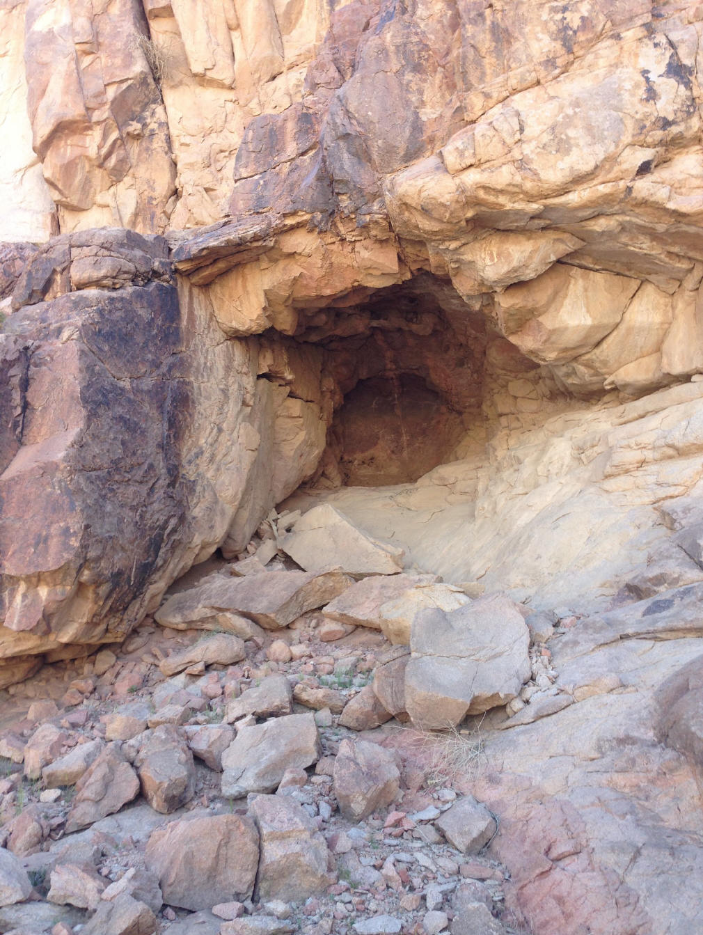
The Rock which Flowed Forth Water

The split rock of Moses, where he was told to strike the rock and water gushed
out. Northwest of Mount Sinai. Drone photo Kevin Fisher
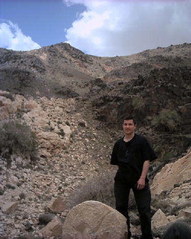
On the western or back side of the mountain is Rephidim where
Moses and the Children of Israel first encamped before reaching Mt. Sinai.
It was here that Moses struck the rock, above, which gushed forth large quantities of water. The
giant 60 foot rock is on a 300 foot tall hill, and has obvious signs of water
erosion, yet it is located in this desert region. The fissure in the rock
is so large that you can walk easily through it. A square 20 foot altar is
also at this site,
which was built after the Children of Israel defeated the Amalakites. The Amalakite territory
covered "south of Judah and probably extended into northern Arabia"
Britanica.
Above - Water erosion in the split rock. Kevin Michalek.
Photo Kevin Fisher
Above - Aaron Sen stands in the split of this giant rock. Notice the
obvious signs of erosion,
in this desert region.
www.wyattarchaeology.com
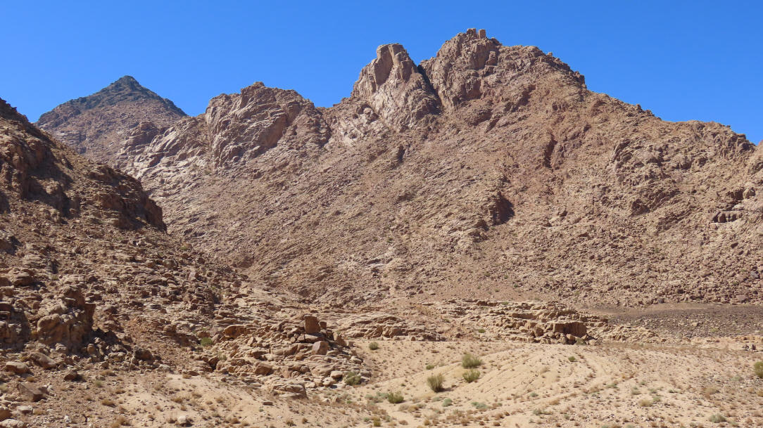
Josephus Said It Was the Highest Mountain
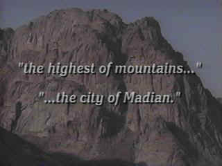
Josephus said that Mt. Sinai "was the
highest of mountains in the city of Madian" which is just outside the town
of Al Bad. Jebel el Lawz is the highest mountain in the upper two thirds
of the country. Also, Philo said Mt. Sinai was located east of the Sinai
Peninsula and south of Palestine.
Subscribe to our YouTube
Channel
click here and
then click subscribe
Mount Sinai in Arabia
Others have come along claiming to have found
this mountain, but Ron Wyatt was the first. Mr. Wyatt
first went out to the mountain in 1984, and also in 1985. Others came
along after him to inspect the area.
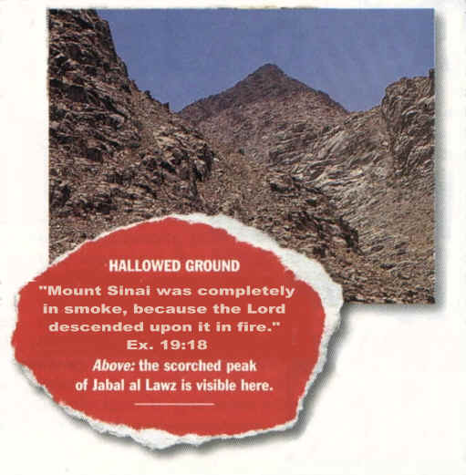
Above: View from atop the blackened peak of Jele el Lawz
or Mt. Sinai, looking down into the
encampment area in the distance. Today there are bedouin buildings there.
Photo Scott Parvi
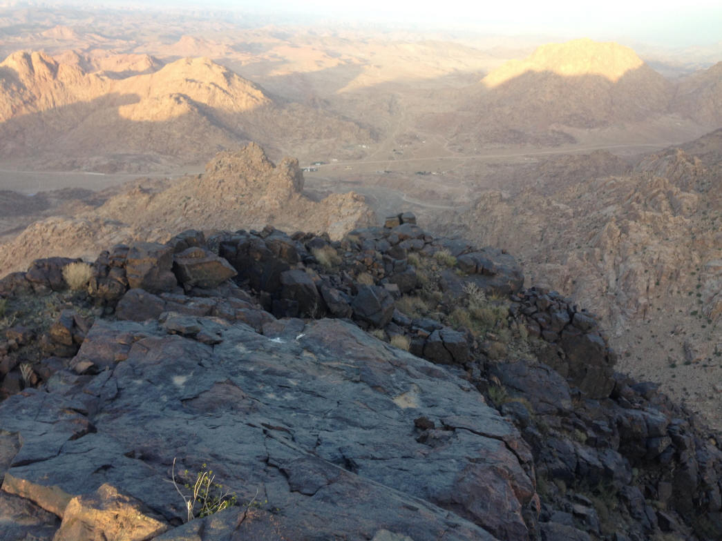
Above: close-up shot of part of the blackened mountain
top. When these stones are tuned over they are brown underneath.
Photo Kevin Fisher
Layout of Mountain & Artifacts
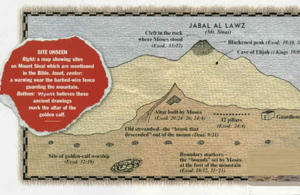
Mr. Wyatt is the original modern-day discoverer of the real
Mount Sinai. The upper 200 feet of Jebel el Lawz is burned black, as we
have seen in previous photos above. The Saudi Government will confiscate any
photographs of the mountain and will not allow any tourists into the country,
but U.S. Government satellite photos and a few private photos smuggled out of
the country reveal the secret mountain by its unique blackened peak.
Unlike the traditional site, there are thousands of acres in which to encamp at
the base of this mountain, while clearly being visible from the mountain top.
Above: Elijah's cave is pointed out. Blackened peak on
far left. Photo Scott Parvi
Above: Elijah's cave which faces toward the golden calf
altar in the distance. Photo Scott Parvi
Multi-million dollar production by
Mahoney Media:
www.PatternsOfEvidence.com
See their new videos about this mountain in their video library!
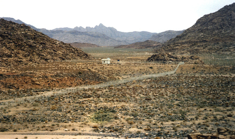
Above: Guard house, government sign, and fence around
the front of Jebel el Lawz
The Altar of the Golden Calf
Above: The base of which the golden calf altar was
placed atop. In the distance is the conical shaped blackened peak of Jebel
el Lawz.
Photo Kevin Fisher
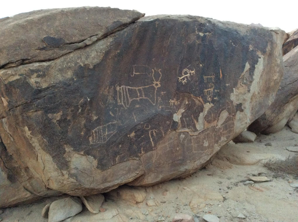
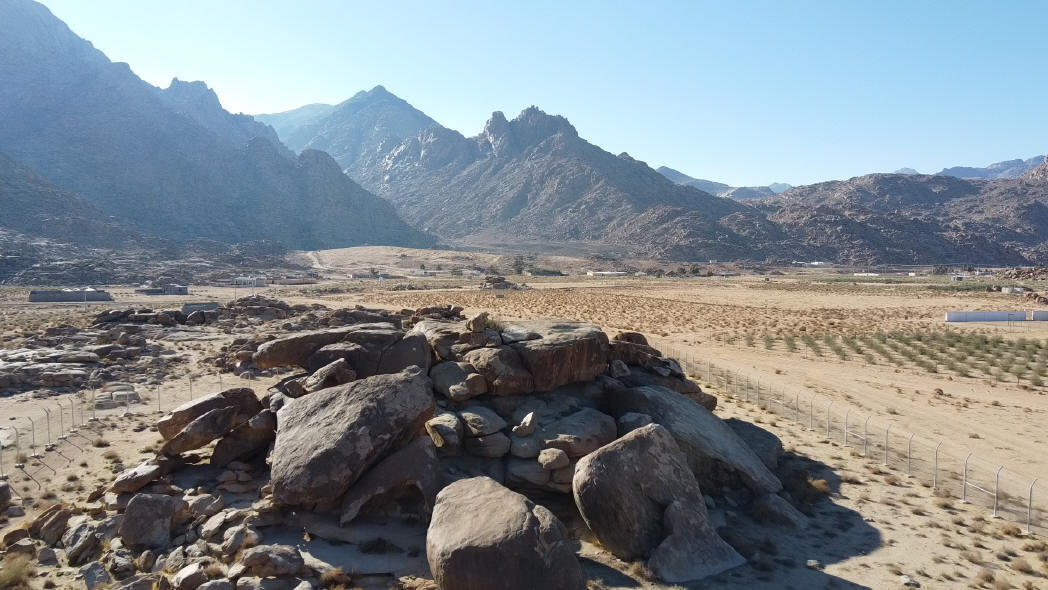
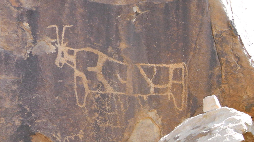
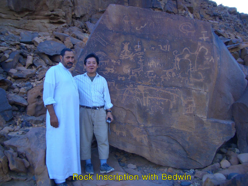
Above - Some of the images drawn of Apis and Hathor bulls on the
altar stones of the golden calf.
A dozen giant boulders are stacked in the encampment area and reveal 12 ancient
Egyptian petroglyphs of bulls. It is believed the golden calf was
placed upon these rocks. Large altars are found on the east and
west sides of the mountain. Photo Scott Parvi
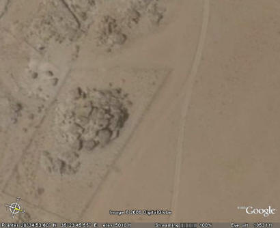
Above: Using Google Earth you can see the fence around these large rocks,
out in the encampment area.
Rocks: 28 34' 52.78" N 35 23' 46.06" E
Guard house & fence: 28 35' 12.50" N 35 23' 08.36" E
Government Acknowledges Archaeological
Significance
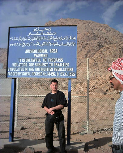
Above - Aaron Sen stands next to government sign
at base of Mt. Sinai
acknowledging this archaeological area. Photo Aaron Sen
After Mr Wyatt found this site in 1984, and visited it again a
year later, the Saudi government erected a fence and a guard house preventing
access to the Holy Precinct area at the foot of the mountain on the eastern
side. The sign above states, "Archaeological area...unlawful to trespass,
subject to penalty." When Ron and his two sons made their fist trip
into Saudi Arabia, they were accused of being spies and were held prisoner for
two months, awaiting execution. After Ron helped to heal many sick
prisoners, the authorities listened to his story and accompanied him to the
column at the Saudi beach, then to Mt. Sinai. It was then they believed him, but
they had to confiscate his photographs before letting him go.
Above - Aaron Sen stands at base of Mt. Sinai with a broken column.
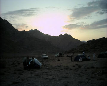
Aaron Sen and Mahoney Media camp overnight in the same spot where
Moses and the Children of
Israel lived for a year at Mt. Sinai.
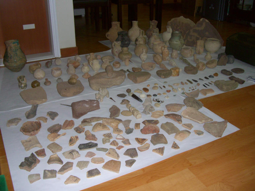
Above: The amazing collection of
artifacts found by Dr. Kim from his 12 trips out to Jebel el Lawz.
Above: Dr. Kim next to drawings in the
encampment area. Dr. Kim was a personal physician
to a prince in Saudi Arabia and to the king. He lived in Saudi
for around 15 years.
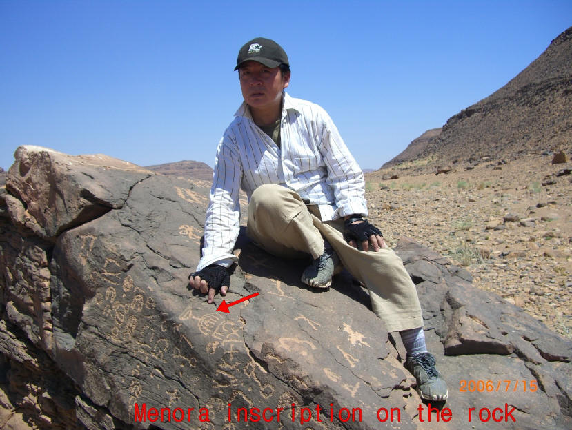
Above: In the encampment area, Dr. Kim pointing
to the oldest image of the golden oil lamp stand ever found.
This was where the golden lamp stand was first made.
Sadly, this menorah or lamp stand image has been destroyed.
Hershel Shanks, editor of Biblical Archaeology Review was
quoted in Newsweek saying "Jebel el Lawz is the most likely site for
Mount Sinai."


Ron was on CBS News on April 17, 1984, telling about his trip to
see the mountain and what he found there. He had entered the country
without a visa and was thought to be a spy. He and is sons spent 76 days
in prison and could have been executed, but God delivered them. Ron made
these comments on air:
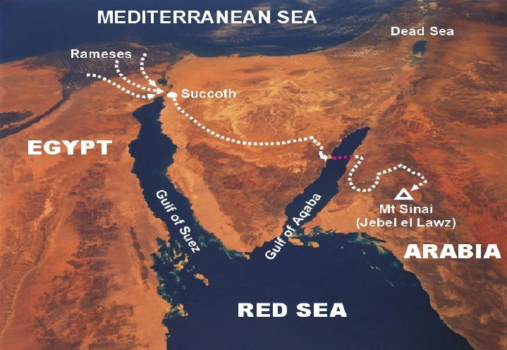
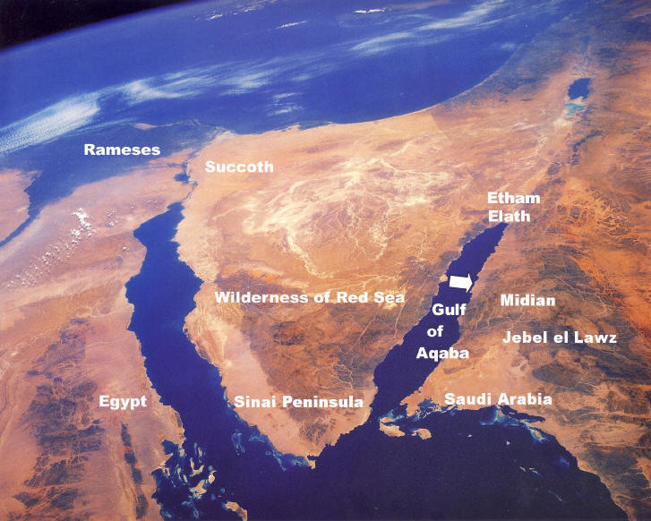
"We found some chariot parts that
looked like the chariots found in King Tut's tomb in the Gulf of Aqaba, WEST OF
THIS JABEL EL LAWZ. Now, we found these at depths from 60 feet out to 200 feet
and over a stretch of about a mile and a half. And we believe that was the
crossing site, so in the Biblical narrative, they arrived at Mt. Sinai after
crossing the Red Sea. The language in the Bible indicated that they stayed 'IN'
A MOUNTAIN; ENCLOSED IN A MOUNTAIN. So, an aerial map showed that this JABEL EL
LAWZ HAD A LARGE VALLEY ENCLOSED IN THE RIM OF AN ANCIENT VOLCANO. There's about
5,000 acres in there. We felt this was the place. And, in Exodus 24:4 and
Leviticus 6:28, 11:33 and 15:12, it tells of SOME ARTIFACTS that were to be
found. There would be TWELVE PILLARS OF STONE AND AN ALTAR AND SOME POTTERY, and
so this is why we looked at that particular mountain."
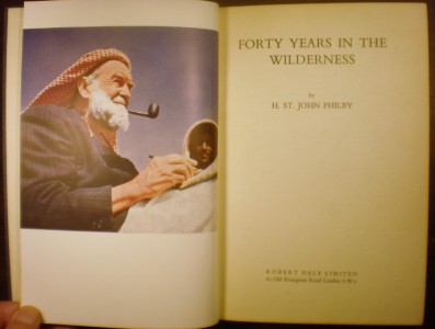
The British author and archaeologist H. St. John Philby spent a significant
portion of his life exploring the wadis and mountains of northwest Arabia -- the
biblical land of Midian. In the book he wrote following his exploration of
Midian, Philby outlines his adventures in the mountainous land:
"From here my guide and I climbed up the cliff to visit THE 'CIRCLES' OF JETHRO
on the summit of Musalla ridge, from which we climbed down quite easily to our
camp on the far side. [Alois] Musil tells us that he had to fetch a circuit of
two kilometres to approach the ridge from the north; but the more direct
approach presented no difficulty. A cairn marked the spot where JETHRO IS
SUPPOSED TO HAVE PRAYED, and all round it are numerous circles, the significance
of which is difficult to guess: presumably some stance marked out for the
benefit of pilgrims visiting the scene of Jethro's argument with the Midianites.
from here I had a magnificent view of the WHOLE OF THE MIDIAN MOUNTAIN RANGE:
with LAUZ and its sister peaks in the northeast and Maqla' a very little north
of east, with the valley of al-Numair separating the latter from the long low
RIDGE OF ALL MARRA, extending from east to south-east, where the TWO PEAKS OF
HURAB stood out in front of the great range of Zuhd, which runs down to a point
not far from the sea to our southward...the spot that held my imagination was
the smooth, double-headed, granite boss of HURAB (pronounced HRUB by 'Id), AN
OBVIOUS CANDIDATE FOR IDENTIFICATION WITH THE MOUNT HOREB OF THE EXODUS, with
the burning bush and the tablets of the Law: THE ONLY CANDIDATE FOR THE HONOUR
WHICH CAN CLAIM TO HAVE PRESERVED THE NAME.
"So
far as I am aware the existence of THIS HILL IN MIDIAN HAD NEVER BEEN NOTED
BEFORE; and naturally I was anxious to explore it and its surroundings....A
couple of miles brought us to the edge of a wide chasm, with forty-foot cliffs
of sandstone and silt along the left bank, and an easier rise on our side,
strewn liberally with large granite and basalt boulders from the steep flank of
HURAB just ahead of us. The Land-Rover could go no farther, and I made my
inspection of the valley and the edge of the mountain on foot. The massif is
granite, with dykes of basalt at intervals, running from south-west to
north-east at an angle of thirty degrees. I did not attempt to emulate Moses'
feat of climbing it, if indeed he did; but I made a careful search in the valley
and its sandstone cliffs in the hope of finding a few Badawin wasms, but the
channel itself, 100 yards wide and thickly covered with acacia bushes and trees,
and the deep gorge of the mountain from which it emerges, were quite impressive....According to Hasballah,
the name of Hurab applies primarily to the wadi, while he called the mountain
itself Al Manifa (which simply means 'the
lofty')." -- Forty Years in the Wilderness. Ernest Benn Ltd.,
London. 1957, pp. 222-224.
Philby never saw the blackened peak
of Jebel el Lawz from what we can tell it was snow covered at the time. So others in the past knew about this
mountain but the evidence was never brought out for the world to see.
Some Television Coverage....
Dateline NBC has featured Jebel el Lawz in its
program
and this has aired multiple times.
The 700 Club has featured Jebel el Lawz also.
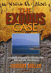
The Exodus Case book
A wonderful book is available covering the real Mt.
Sinai in Saudi Arabia called The Exodus Case. You may
order it from www.amazon.com Written by a Swedish scientist,
Dr. Lennart Moller, who has extensively researched
the material first-hand. The book has over 550 color illustrations
including topics of Sodom and Gomorrah, the Red Sea Crossing, the real Mount
Sinai, and Joseph's grain storage complex.
See Pics and
Transcript of PAX Television 11-9-2001
Featuring this REAl Mt. Sinai